|
|
|
6 October 08: The river to the ocean goes,
a fortune for the undertow; or,
Indian Summer of the Delaware
Me, my thoughts are flower strewn. Ocean storm, bayberry moon. I have got to leave to find my
way.
Back on Friday the 13th of June, I spent the day on the Delaware River, tagging along with Delaware River City
Corporation and Philadelphia Industrial Development Corporation as they showed a delegation of
Argentineans (including two mayors of Buenos Aires) around town, from a diplomatic welcome with Mayor Nutter at City Hall past Independence Hall to several points
along the riverfront: Waterfront Square, Pennypack Park on the Delaware (which DRCC is in the process of extending to the mouth of Pennypack Creek itself, where it will ultimately take Pennypack Park to the Delaware), Lardner's Point (a park which
DRCC is developing on the land adjacent to the south side of the Tacony-Palmyra Bridge)
and the Navy Yard (whose development and master plan PIDC oversees from on site). Seemed like a fun
way to spend a Friday and hear the opinions of some South Americans on how we're handling the riverfront that Philadelphia's been watching so closely these last few
years, whether because of two force fed casinos or channel deepening (DREDGING = JOBS) or Penn Praxis' central riverfront study.
Later that day, I took the R3 to West Trenton to meet a friend and head to his lake house in North Jersey. Having forgotten a book to read, I spent the hourlong
ride through towns I'd never heard of (Rydal? Bethayres?) soaking in that day on the Delaware before crossing it 30-some miles upstream. The following morning, my
friend dropped me off in Newark on his way to New York and I caught the Northeast Regional home to 30th Street Station, back across the Delaware at TRENTON MAKES
THE WORLD TAKES and watching the river out the window on the way home. Something about all of this clicked, with my Fishtown house three blocks from the river and
my childhood love of geography and the shape of Pennsylvania burned in my brain.
By Monday, I'd decided that Philly Skyline could do a whole series on the Delaware across the summer, with an intro on the solstice and a grand finale on the first
day of fall, and trips to the headwaters and the mouth and the places that exist and people who survive in between because of it. Got to some, didn't get to some.
Ça va. While I'm still sitting on a million photos and half/unwritten essays and still four more tidal Delaware bridges, I wanted to make sure I got to the
'grand finale' while the weather was still beachy.
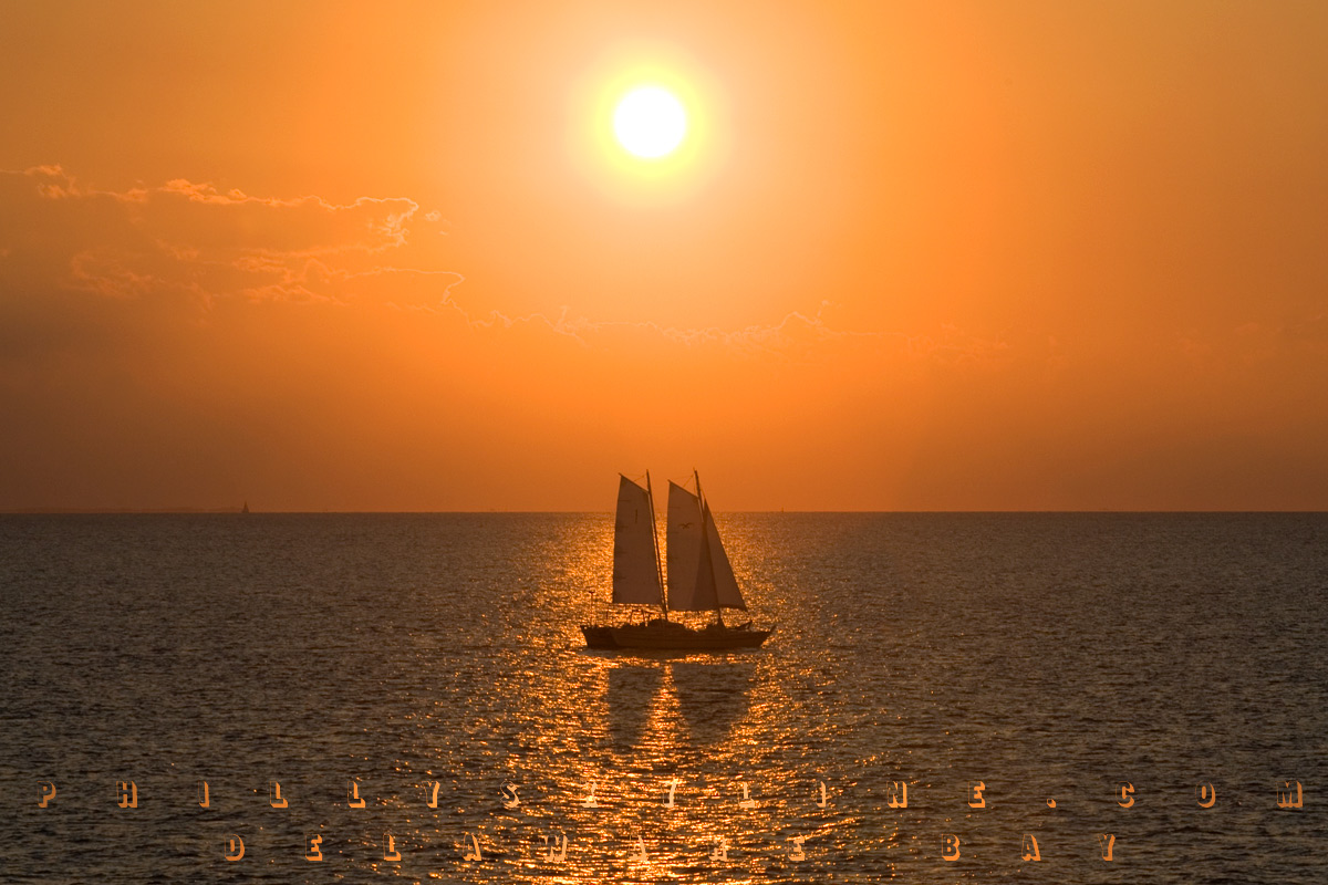
So, this past weekend, I dragged the wife along to take the picture I've had in my head since the beginning of summer, sunset over the Delaware Bay, taken from the
Cape May-Lewes Ferry, to mark the end of the Summer of the Delaware at the end of the Delaware. I also packed an exhausting list of Delaware River/Bay points that,
in hindsight, was far too much to cover in two days. In fact, retracing our route, we barely scratched the surface.
The Bombay Hook Wildlife Refuge, the burnt out Port Mahon lighthouse, and the small communities along the Maurice River (which is
the longest tributary in the Delaware Bay and which I understand is pronounced "Morris") . . . we'll getcha next time. This weekend's voyage, from G-Ho to Reho and
back, went a lil' something like this . . .
The only time I'd ever crossed the Delaware Memorial Bridge was on a trip from Savannah, Georgia to New York City, in February 2003. I remember seeing the Philly
Skyline on that crisp winter day, crossing the peak of the twin span a good 30 miles south. Hoping to replicate that view, we headed south on 95 to see what's
changed in those five and a half years. The above photo is the confirmation, from the southbound span looking across the northbound span and DuPont's Deepwater
facility. Heading south . . .
* * *
. . . and into Pennsville (the South Jersey township named for William Penn, not to be confused with the South Jersey borough named for William Penn, Penns Grove,
just north of the Del Mem). Pennsville seems like a sleepy community, but it's very much in touch with its Delaware River. Un-fenced beautiful homes line the sandy
bank south of the Delaware Memorial to Riverview Beach Park, a clean and kempt open space that was once an amusement park. The gateway entrance to the park still
stands today. Along the river is a paved walkway and a concrete bulkhead with views of the river, the twin bridges and the Delaware lands they lead to. In the
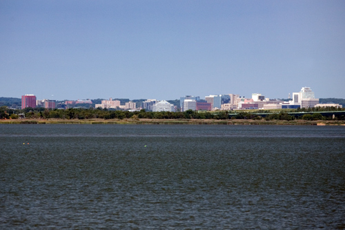
river, you can see the remnants of a pier from the amusement park and the ferry to New Castle that the twin bridges replaced. The photo above is the Wilmington
Skyline (which, interestingly, is situated on a riverfront -- the Christina River -- which on its way to the Delaware widens and serves host to the Port of
Wilmington).
* * *
On the far southern end of Pennsville is a neighborhood that apparently was never developed. Compare the map with the satellite view at Google Maps HERE. It's a little like Centralia, only the roads weren't ever built. Just south of this is an even weirder part of New Jersey: part of it that
is not even New Jersey.
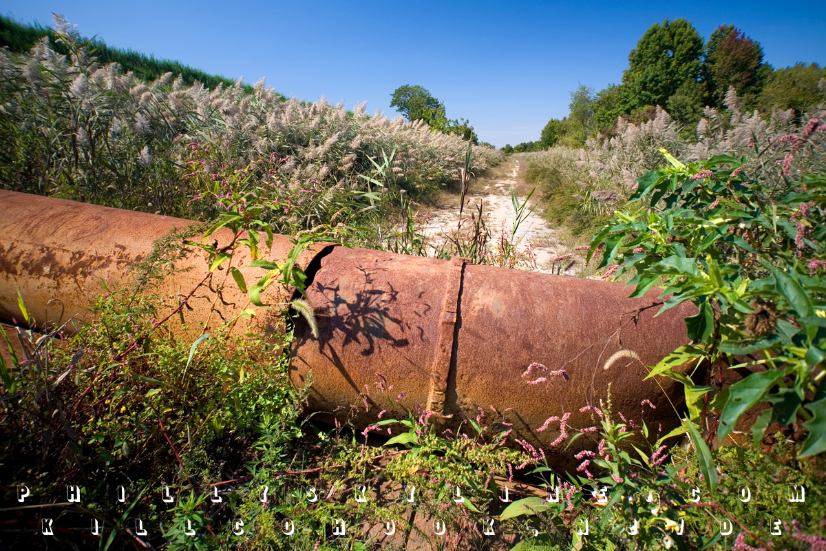
The Kilcohook Coordination Area is a not-quite-off-limits but not-exactly-advertised, 600 acre portion of the state of Delaware on the east side of the
river. The Army Corps of Engineers built the ground up with dredge spoils on land deeded to William Penn from the Duke of York in 1682. Exactly why it belongs to
Delaware is complicated. The rounded northern border of that state extends from the '12 mile circle' centered at New Castle County Courthouse. That 12 mile circle
also included a good bit of land across the river, but for practical reasons was never really accepted as Delaware. It took a dispute between the two states for the
US Supreme Court to rule in 1934 that Delaware is entitled to land on the Jersey side -- "all the land up to the low-tide line on the river's eastern shore."
(Press of Atlantic City via Cumberland
County Talk.) Matt O'Donnell did a feature story for 6ABC on this in January 2007, archived online HERE.
The photo above is at the north side of Killcohook, where Lehigh Road dead ends at this barrier. The barrier, placed there by the Corps, presumably prevents use and
abuse from vehicular traffic. Still, one can hike or, for example, ride a dirt bike back the several unpaved roads, all the way to the southern end, where
Killcohook meets up with the post-Civil War Fort Mott.
* * *
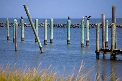
Fort Mott is one of the Three Forts of the Delaware. (Fort Mifflin and Fort Mercer, in Philadelphia and National Park, make five, and there are former Swedish and
Dutch forts along the Bay which no longer exist.) Along with Fort Delaware in the middle of the river and Fort DuPont in Delaware City, Fort Mott is served by a
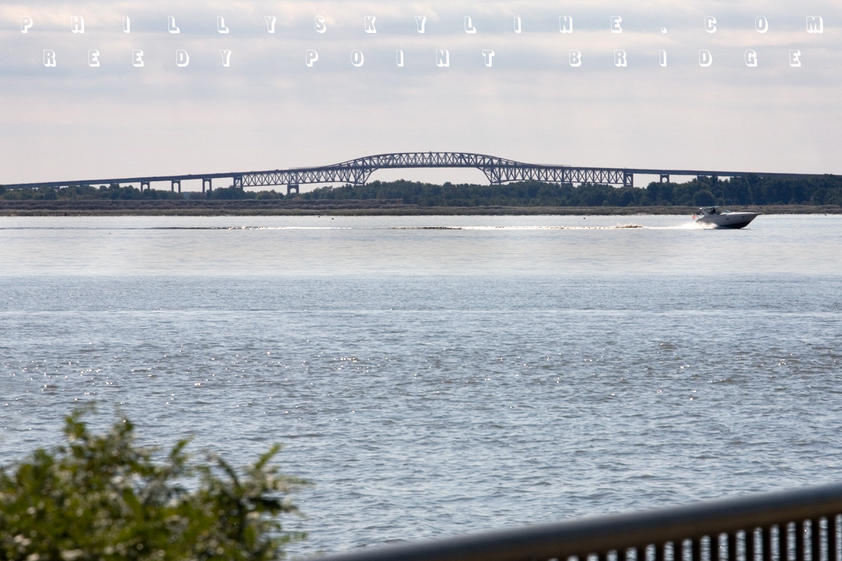
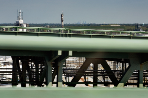
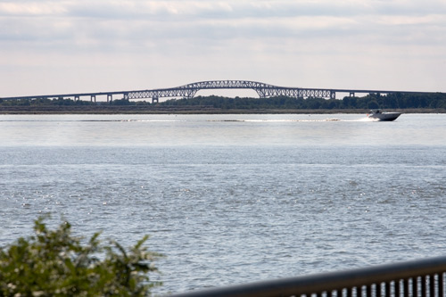
passenger ferry. The riverfront at Fort Mott (now a state park) has a promenade looking back toward the fort, south to the Salem nuclear station, and across the
river to the Reedy Point Bridge, seen above. Built in 1968, the two lane cantilever bridge spans the Chesapeake & Delaware Canal, which opened in 1829 and shaved
off a good 300 miles in the maritime trip from Philadelphia to Baltimore. The bridge was included in funding authorized by Congress in 1954 to widen and deepen the
C&D.
* * *
Let's fast forward a bit now, past Hancock's Bridge (site of a horrible overnight massacre by the British in 1778), past Hope Creek -- the official marking of the
Delaware River's shift to Delaware Bay on the Jersey side -- past Cohansey, Nantuxent and Maurice Rivers, past the small rural bayside towns to a more familiar
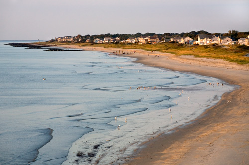
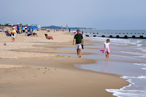
shore, as in down the. Cape May, the stuffy victorian resort town at New Jersey's southern point, has been popular with beach goers since long before the
railroad, and later the Garden State Parkway, brought out-of-staters here. But for the signs to the ferry, little attention is given to the Delaware Bay side of
the cape, and that's just how its residents like it. With a sunset over water to rival its sunrise over the Atlantic, the bayside beach is pin-drop quiet compared
to the ocean beach a couple miles away.
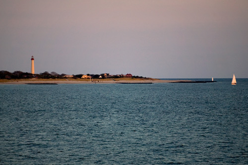
At the beginning of this post is the Cape May Lighthouse, which sits at the tip of the cape, where the Delaware Bay reaches its goal, the Atlantic Ocean.
* * *
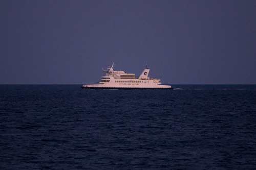
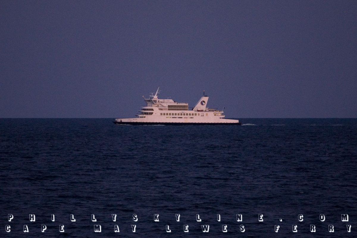
This here is a northbound Cape May-Lewes Ferry, seen from a southbound one. This photo (ISO 1000, f4.0, 1/125) was taken around 7 Saturday night, about
twenty minutes after the sun had set over Delaware Bay. The ferry began operation in 1964, providing a link between Jersey shore towns and Delaware/Maryland shore
towns. Ocean City and Ocean City were never closer before the ferry. US Route 9 (known in North Jersey as the 1 & 9, as it shares a prominent section with US-1)
officially crosses Delaware Bay on the Ferry's fleet. Each ferry holds up to 100 cars and 1,000 passengers.
The 17 mile journey takes 75 minutes and costs $34 for cars ($41 during peak summer months), $29 for motorcycles, and $9.50 for pedestrians. If I might offer a
recommendation, I'd suggest the southbound ferry at sunset and a room in Rehoboth Beach, less than ten miles from the ferry terminal in Lewes, Delaware.
* * *
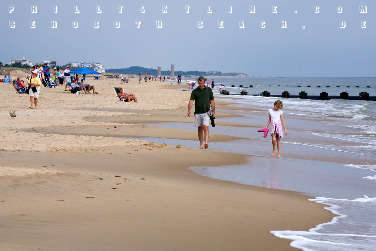
Rehoboth, it must be said, is a killer little beach town. While it has all the tchotchkes and garishness any shore town has, it's a little more openly gay friendly
than most, and oh yeah, it has the Dogfish Head Brewery. Rehoboth is the first resort town south of Cape Henlopen, Delaware state's farewell to the Delaware
River/Bay. You can see the Cape in the distance in the photo above. Rehoboth acknowledges its Delmarva existence with streets named for the Delaware, Atlantic and
Chesapeake each. (Philadelphia Street is two blocks south of Wilmington Street, which is two blocks south of Baltimore Avenue.)
* * *
Heading north on Delaware's main line, State Route 1, the scenery turns quickly from outlets to farmland, with some marshland off to the right. That includes Prime
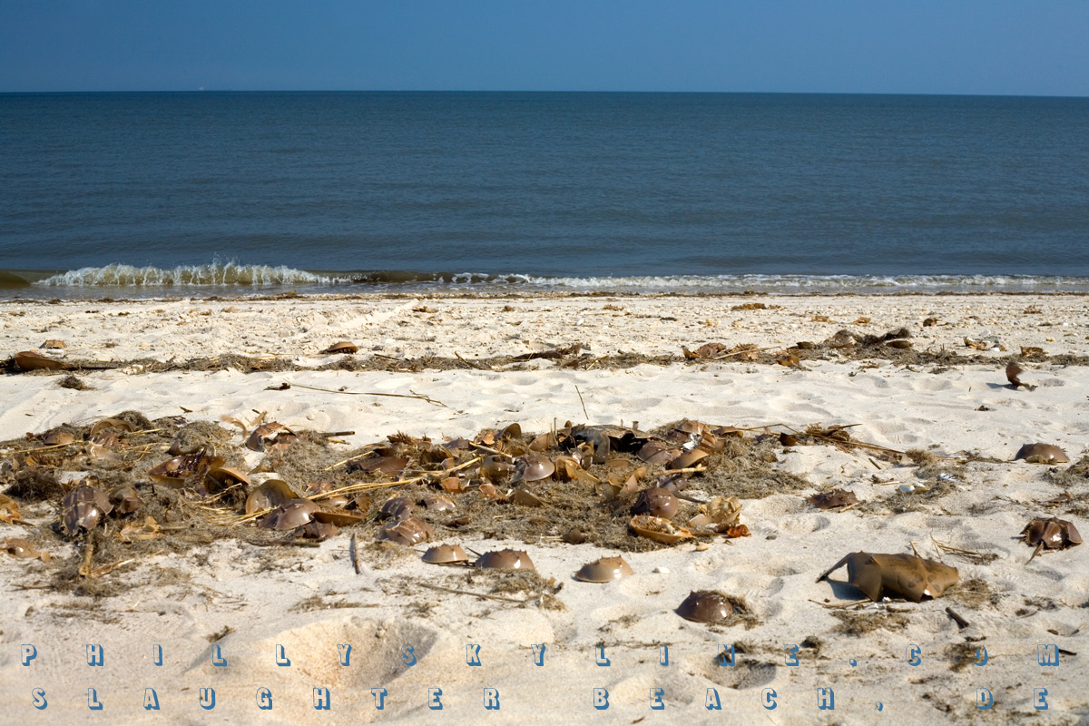
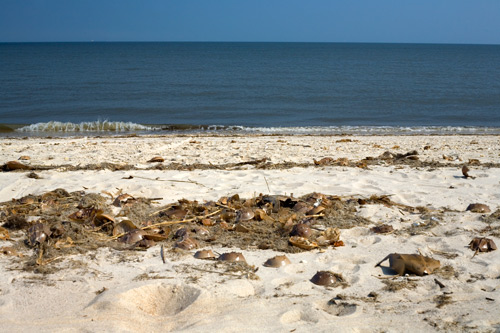
Hook and Bombay Hook Wildlife Refuges, home to tons of migratory shorebirds -- and mosquitoes and ticks. In between these is the small community of Slaughter Beach,
pictured above.
The 2000 US Census says Slaughter has a population of 198, but seeing it in person, I'd guess it's probably closer to 19. What look like vacation homes line
the shore of Delaware Bay, with only two small public parking areas. Once you're on the shore, though . . . wow. The tang is not of bay nor ocean air, but of dead
horseshoe crabs, which are everywhere. Rumor has it that's how the town got its name -- from the thousands of horseshoe crab carcasses after coming ashore to spawn.
Their scent is not overpowering, though, and the beach is calm and beautiful. Slaughter Beach is near the widest part of the Bay, i.e. furthest from Jersey, so you
can't even see the other side. You can, though, see the giant ships in the channel on their way to and from Philly, Camden, Wilmington and other points north on the
river.
* * *
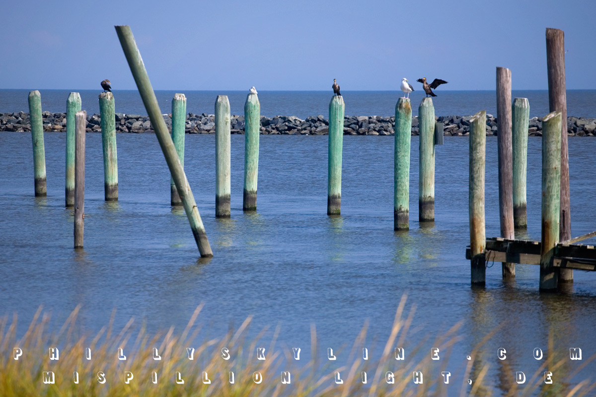
Just north of Slaughter, at the mouth of the Mispillion River, is the new DuPont Nature Center. The Mispillion Lighthouse occupied this site from 1873 to 2002, when
it was mostly destroyed by lightning. A Lewes-based enterprise purchased and moved what was left of it to build a replica at Shipcarpenter Square in Lewes. As part
of its Delaware Estuary Initiative, the DuPont Corporation contributed $500K of the Center's $2M
construction by the state of Delaware. The Center includes exhibits on birds, horseshoe crabs (which includes a tank of juvenile crabs) and bay views like the one
above.
* * *
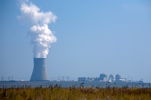
Back up north, past Liston Front Range Lighthouse -- which marks the Delaware side of the River/Bay change -- we'll make a stop in Port Penn, the tiny Delaware town
across the River from the facility pictured above. Generally called the Salem Nuclear Station, it's technically two facilities: the Hope Creek Nuclear Generating
Station (including the cooling tower that can be seen from Center City on a clear day) and the Salem Nuclear Power Plant, the round reactors just behind the double
masted ship. Together, they make up the second largest nuclear facility in the country. Both facilities are owned and operated by PSEG Nuclear. The Salem station's
web site is HERE.
* * *
With a stop off in New Castle, it's evident we're getting close to home. Old New Castle is one of the better efforts of colonial preservation in the Delaware
Valley. The town dates to 1651, when the former Lenape village was settled by Peter Stuyvesant and the Dutch. After the Swedes wrestled it from them a few years
later and the Dutch wrestled it back a year after that, the British took the helm in 1664 and changed New Amstel to New Castle. It was under British rule when
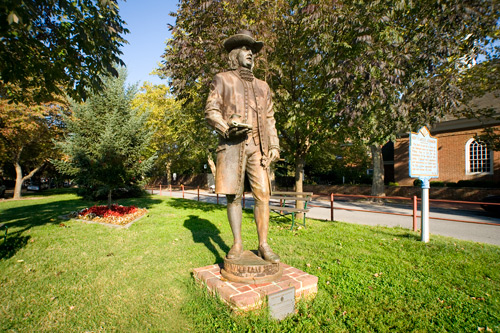
William Penn arrived in 1682. The statue above stands behind the old county courthouse (old because the New Castle County seat is now in Wilmington) on the Green --
which was laid out by Stuyvesant and the Dutch.
* * *
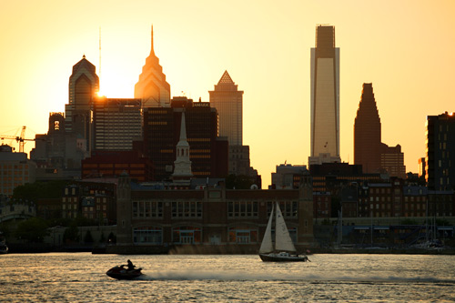
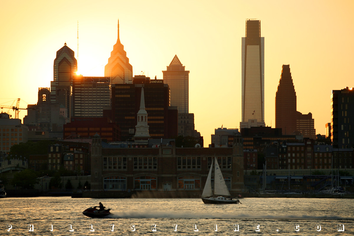
Finally, at long last, at the end of our Delaware River-Bay journey, we leave Stuyvesant's town green (as fine a place to watch the Phillies' deciding NLDS victory
over the Brewers as any -- get the pizza at Portofino) for Penn's green country town. About 33 miles upstream from New Castle is the town Penn ultimately gave his
direction, a town 90 miles from the Atlantic Ocean called Philadelphia. This sunset over the Philly Skyline looks maybe a little different than Billy Penn would
have seen it.
* * *
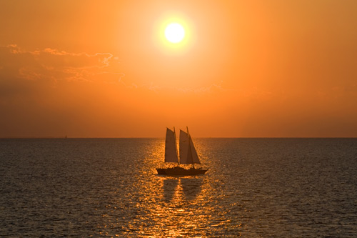
But sunset over the Delaware Bay -- the very reason for this exhausting trip? Looks as great now as it did in the head Quaker's day.
Some other photo essays from Philly's Delaware are coming this week.
–B Love
|
SUMMER OF THE DELAWARE ARCHIVES:
|
|