|
Consider this: the Park West development at 52nd & Jefferson is comprised of a 22 acre section of dormant rail yard and 8 acres where rowhomes had been. That's
31 acres.
The Logan Triangle, fronting Roosevelt Boulevard just east of Broad Street, makes up 33 acres of empty parcels on the city's grid (empty because the homes were
condemned
and the city shipped their residents elsewhere). If you add in the physical space the streets occupy, the acreage ups to 40.
Park West is under construction as we speak, and two developers have applied for the Logan Triangle site. (More on this next week.) Thirty-three and forty acres
are pretty big development opportunities, no? If so, then what does that make the 200 acres of Conrail land that sits unused along the Delaware River in Port
Richmond?
It's 225 if you include next door's Anderson Yards. (Ha ha, Anderson Yards. Sounds like something you'd see on Friendster.)
The Conrail-Anderson yards (henceforth "Conrail yards") are an integral part of the riverfront planning study. Everyone involved in the planning and everyone
paying
attention to that planning is well aware of the otherwise best kept secret in Philadelphia.
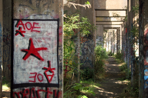
I'd go so far as saying that one of the best parks in the city is not a park at all, but a rogue gathering ground, a post-apocalyptic paradise whose very
existence I'm
torn even talking about. But there's a whole photo essay waiting.
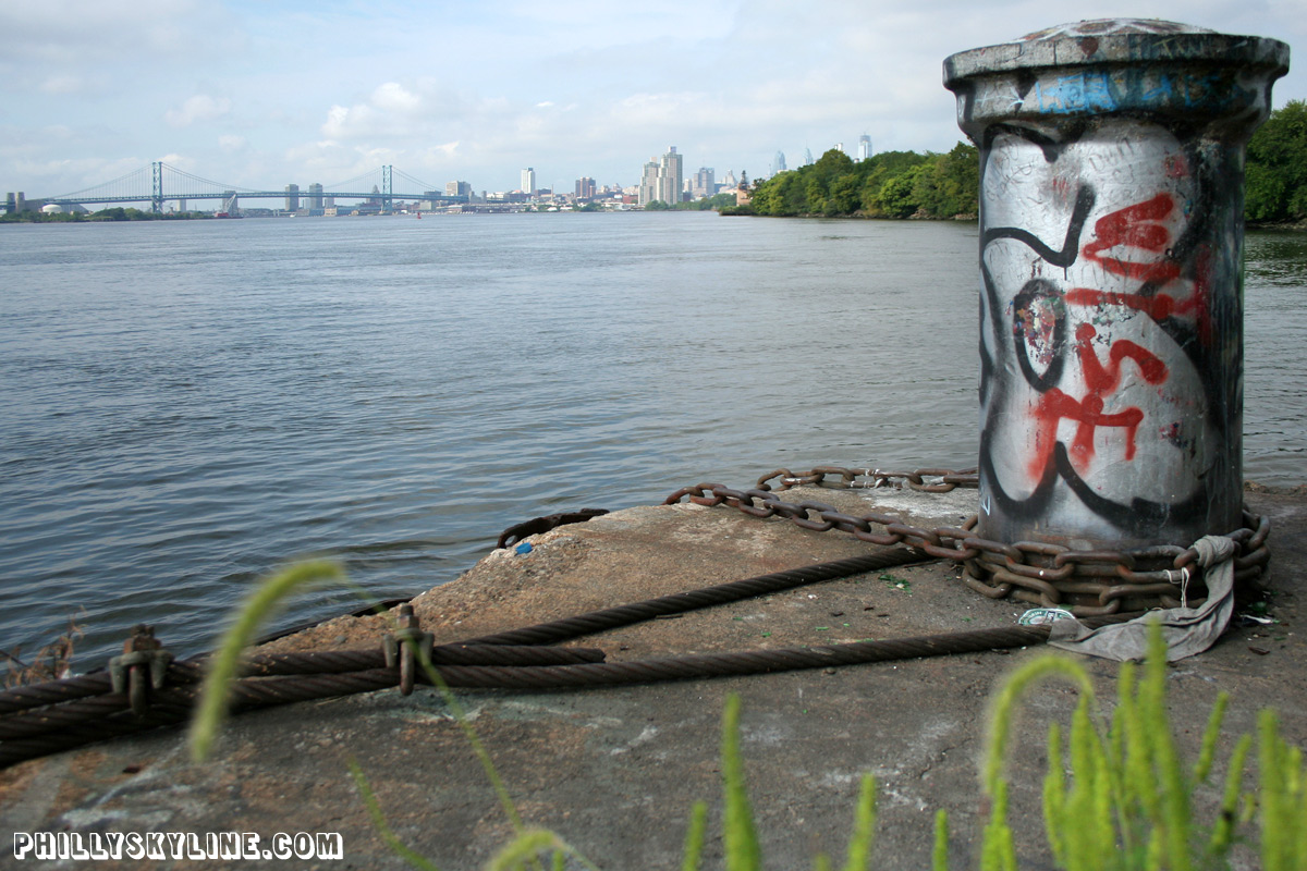
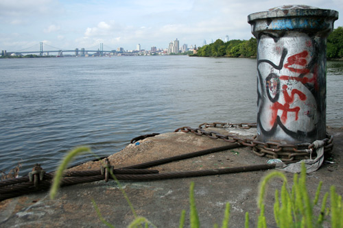
Twenty different photographers would see the Conrail yards in Port Richmond twenty different ways. One might see it as old man Cramp's shipyard, building wooden
ships for the Civil War and ironclads for both World Wars. Another might see it as the birthplace of the Slinky, before the Slinky moved its operations (down stairs alone
or in pairs) out to Hollidaysburg. Chris Dougherty might see it for the McMyler coal dumpers on Pier 18, one of a dozen piers in the old Port Richmond Wharves. (See the
post directly beneath this one for more on Pier 18 by Chris.)
Or, maybe you'd see the Conrail yards for, well, Conrail. The Consolidated Rail Company has owned the land since the company was formed in 1976 by the consolidation of six
bankrupt railroad companies, both freight and passenger. After two decades of success, Conrail broke up its operations in 1997, with Norfolk Southern and CSX acquiring
most of the network and rolling stock, but with Conrail retaining assets in three areas including Philadelphia and South Jersey.
Conrail still operates the Port Richmond facility, but only along the northern end. The viaduct that parallels Lehigh Avenue was once ten tracks wide -- stand under the
Frankford Ave underpass, look up and count 'em. Nowadays, only one track runs the length of the viaduct; two tracks from directly under 95 to the river. Compare these
three maps:
1927, pre-I-95:
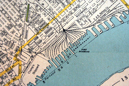 (map by Hagstrom's)
1983, WTF is/was Quay Pier???
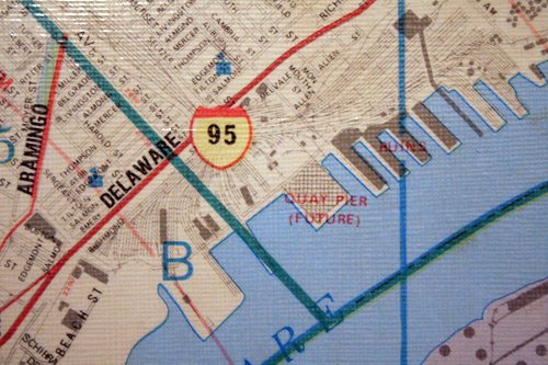 (map by Champion National Map Corporation)
Google maps, 2007:
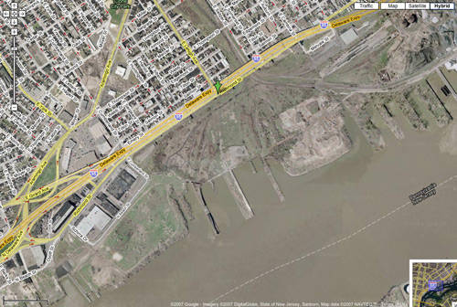
Two hundred twenty-five acres of unused land, from the PECO substation at Penn Treaty Park to the port next to Pulaski Park. Scratch that -- that's 225 acres of
officially (or to sound a bit more draconian, legally) unused land. It's used all right. To four wheelers and dirt bikes and paintballers, it's heaven.
Mounds of dirt and puddles of mud and gravely trails form a steeplechase that answers the questions of many a Kenzo: "exactly where in the hell are those kids on their
dirt bikes riding to?" Chances are, they're riding to the Conrail yards.
It could be redeveloped, sure. The southern half of it was the site of the proposed Pinnacle casino. You know, the one of the five that made the most sense. It probably
would have been met with the least resistance, too. But, as South Philadelphians and Fishtowners well know, Pinnacle didn't win a license. Besides, Pinnacle has a billion
dollars invested in Atlantic City; their hearts weren't broken.
So here sits 225 acres of land. What's next? For starters, a reconfiguration of the Girard Avenue exit of 95 and reconstruction of a portion of 95. Structurally
deficient and all that, y'see. The last standing Cramp's building will stand no more. Delaware Avenue is supposed to be reconfigured as well, taken a little closer to
the river. With any luck, the grand boulevard of Penn Praxis' riverfront study will take shape, with passenger rail in its own right.
The land itself? I don't know. What do you think? Do you want to see the grid extended all the way to the river, with an all-new neighborhood of rowhomes? That's boring.
An amusement park? OH MY GOD THINK OF THE TRAFFIC. A casino? Ha ha. A giant park? Fairmount Park Commission is strapped enough as it is. A living museum?
Who has the answer? Do you have the answer? If so, let's hear it. Put on yr thinking cap, visualize 225 acres of riverfront land, and send your ideas to blove AT
phillyskyline DOT com. I'll follow this post up next week with the best ones.
For now, have a look at these photos, taken with CDoc two Sundays ago. |